Sunday, January 17, 2010

First Century of 2010

Never having ridden 100 miles in a day in January before, I decided to try turning my monthly Appalachian Gap ride into a century attempt. Saturday was the second day of a January thaw, and I headed out a bit late, at 1 pm, with temps in the mid-30s. I drove to the end of the dirt road to start on a road bike, my trusty Atala fair-weather commuter, a low-end racer from the early '80s, to which I had fitted fenders and a rack. In spite of its carbon steel "Tullio" tubing, the bike's classic Italian racing geometry makes it a nice riding machine. I have replaced most of the low-end Campy and other Italian parts over the years with less interesting, but more functional mid-range Shimano bits, though I kept the Modolo Flash brakes, just to keep a little of the traditional "excitement" in the bike.

The ride started out well, with the sun peeking out from time to time. The ride up the Gap was uneventful. I felt pretty good and got a few honks and waves from cars coming back the other way. I was protected from the wind until the very top. The road was clear all the way over and, with the chilly wind and not much of a view, I only stopped long enough to zip up. Part way down the other side, I thought I'd stop and grab a photo of the eastern view and was reminded of the limitations of my old Italian brakes, taking a hundred yards or so to stop!


Approaching the top of App Gap


The ride down the other side was uneventful, with the exception of the Mad River Glen ski area. I've seen dairy cattle that paid more attention to traffic than downhill skiers, headed for their cars. I skipped German Flats Rd, not wanting to tangle with more skiers from Sugarbush, and bounced along the broken pavement of Rte 100, south of Waitesfield, heading toward Granville Gulf. Although it was only 30 miles into the ride, and I hated to waste the daylight, I had skipped lunch and was getting hungry, so I stopped at the store between Waitesfield and Warren. It's quite nice for a convenience store, lots of glass, always warm inside and a couple of tables at which to relax. A piece of thick, fresh pizza turned out to be a good choice and I drank a large bottle of Gatorade, as I warmed my feet.

It took only about five minutes of brisk riding to get my body heat back up, when I hit the road again. I rode over the top of Granville Gulf and headed down to the falls, where I took a couple of uninteresting photos of the frozen cascade before turning around and heading back up. The ride back down was not as chilly as I expected and I crossed the covered bridge in Warren and headed up the Brook Rd climb. Interestingly, this route peaks at almost the same elevation as Granville Gulf, but does it in a lot less distance. I came out at the covered bridge in Waitesfield, turning on my lights halfway down the descent. I looped down Rte 100B to Middlesex, so I could pick up a loaf of bread at the bike-friendly Red Hen bakery, wondering if this type of supplies run would meet with more approval by Mr. BikeSnobNYC better than Pizza Fixation? No cockles lost their lives dressing up that slice of pizza and there was certainly nothing hip about my rusty, salt-covered Atala, or my cheesy neoprene shoe covers.


The "lazy window" on the house next to
this Warren barn is a Vermont classic.


I chugged against a cold headwind all the way back to Jonesville. Approaching Waterbury, I realized that I couldn't read my bike computer anymore, because the wind was pulling too much water out of my eyes, blurring my vision. Does cycling get any better than this? I averaged a mere 15 mph, but I was in no rush and had done over a mile of sometimes steep vertical gain. All-in-all, a memorable first century of the year, and one that reminded me of how just staying in shape isn't enough if you want to ride long distances. I was quite wiped at the end. I also noticed that, even though you don't get thirsty when working out in the winter, you need to keep drinking. I drank only the Gatorade and a couple of swigs of water during the ride and found myself incredibly thirsty for the next 12 hours and with a dehydration headache the next day.


More pics on Picasa.

Saturday, December 26, 2009

Riding my age on Christmas Day

I checked the weather, and it seemed that the best conditions coming up for riding might just be Christmas day, with no precipitation in the forecast and temps in the mid-20s. I really wanted to wrap up the extended saga of our order of two sets of Ay-Up lights, so I decided to ride the 54-mile loop up to David Tremblay's house in Moretown and pick up the light I loaned him when Ay-Up shorted us one unit. David and I had gone in together on the order to get free freight. When his light was missing, I gave him one of the two I had ordered, while we waited for his to come from Down-Under. The folks at Ay-Up were great, and their lights are not only superb, they are an excellent value. However, this would be the third trip out to David's to straighten things out!

The ride was very enjoyable. Having suffered cold feet earlier in the week riding into work, I tried pulling out the insoles of my winter riding shoes and replacing them with a pair of chemical foot warmers. This did not prove to be all that effective. I could feel the warmth for perhaps the first ten miles, but after that they cooled off and eventually didn't seem to be doing much of anything. There was a light northeast breeze, which slowed me a little on the way out, but made up for it on the way back.

The dirt roads were smooth, but I was reminded when I strayed onto the smooth, icy patches to get back to the snowier sections! Vehicle tires tend to clear the snow and glaze the ice, and the studded tires slipped around when I strayed off the crunchier center sections. I rode out the Duxbury Road, knowing that the road would be nice down by the river. I expected very little traffic, but there were a fair number of cars around.

I decided against climbing Rte 100 up out of Waterbury and stuck to the river until Middlesex. I thought about climbing up the Lovers Lane shortcut, but I was wearying of the icy dirt roads and didn't want to slog through the snow on the abandoned bridge, so I continued on the clear pavement to Middlesex and enjoyed the ride up Rte 100B. I stopped for a few minutes to chat with Bob Lindemann, who was out jogging, then up to Moretown and the climb up the Moretown Mtn Rd. The Moretown snowplow must have a serrated blade, because there were ridges in the icy surface, making things a tad exciting at times, but there were only a couple of cars and the going was fine. South Hill Rd. was easier than it had been before the snow, when it was covered with freshly graded loose sand.

Picasa Photos
David wasn't there, but I picked up the light and headed back. My feet were starting to get chilled, so I took Rte 100 through Duxbury and came back on Rte 2. I stuck to the generator light as it got dark, as the half-moon above the clouds was keeping things light. An uneventful climb back up to the dirt road got me home right about the time my feet were making the transition from cold to numb. The insoles were cold to the touch, but five minutes later, they were steaming--the fickle things. Final mileage was 54.5, my exact age!

Saturday, September 26, 2009

Greylock!

In the spring of 1978, I had just met a really nice girl, who had come into the shop right at closing to buy toe clips for her new Schwinn LeTour. I installed them in the parking lot and summoned up the nerve to ask her for a ride, ostensibly to make sure she was able to use them properly. During the short jaunt, I found the courage to ask her for a date. That worked out well, but it was Friday and she said that she had already made plans to leave town to see her mom that weekend. I spent that Saturday riding one of my favorites--out to the top of Greylock and back--thinking about her the whole way. As it turned out, the story about visiting Mom wasn't a brush-off and we picked up again on Monday. A year later we were married and I think that was the last time I rode Greylock.

Fast forward to today. Jeanne is at her Mom's again, taking care of her, and I happened to be in town Friday for a conference at RPI. I checked the Mohawk Hudson Cycling Club's website (my club, back in the '70s), and saw that they had moved their annual Greylock ride up a week. I've wanted to ride Greylock again for a few years now, but it was closed as the access roads were completely rebuilt. The forecast was for cool, but sunny weather, so hooking up with them for a ride was a no-brainer. I needed to ride into work on Friday, with Jeanne picking me up at the end of the day to travel, so I decided to take the Gunnar cyclocross bike, as it has a rack, but fairly light wheels. I also thought the triple might come in handy, but as it turned out, it wasn't needed.


54 degrees at the start didn't feel cold under the bright September sun. There was a good turnout of riders of a variety of abilities, but all appeared to be in decent shape. I chatted with the owners of a Tommasini and a Colnago Master, both classics in excellent shape, but with upgraded parts. Most riders were on very nice, modern bikes. I left with the first group and the pace quickly picked up to the point that I wondered if I would be able to keep it up over the entire 70-mile ride. I dropped off the lead pack on the long climb before Stephentown, but caught up on the rolling terrain. They finally dropped me for good on Brodie Mountain Road when I lost contact on the climb and then missed a turn. When I rejoined the route, the main bunch was just going by. I passed most of them, grabbing a few photos, and eventually caught up with a few riders from the lead group.


The ride up the south side of Greylock had a few good pulls in the beginning, but was much less steep than I remembered. I actually started picking up the pace after awhile. Things really started to feel familiar when I hit the tight double-switchbacks near the top and I put the hammer down to the summit, realizing how much easier it was turning out to be than expected.

After resting awhile at the top, and sharing my trail mix with some of the other riders, I started back down. The views were fantastic in the clear, late-September air and the foliage was just starting to turn. Riders had been coming and going, so I was pretty sure I'd either catch up with some or be caught by others. The fastest riders were long gone, including one amazing woman who had bucked the stiff headwind for the fast bunch for most of the ride out.

As it turned out, I rode solo all the way back to the start. Other than a number of riders still climbing up, I didn't see anyone until I had my bike loaded and was getting ready to leave. I had a nice tailwind most of the hilly return ride, so I kept a brisk pace and took advantage of it. When I finished, I felt like I had gotten in a great workout--much more than one would expect in 70 miles. Total climbing was over 7,000'.

The ride was a real blast. The other riders were pleasant and there was usually someone to draft or to pull. 30+ years ago, I spent the ride thinking about a special girl I had just meant. Today, I had over three decades of fond memories to reminisce about as I revisited this great tour. All-in-all, it was big, big fun.

More photos on Picasa.

Wednesday, August 26, 2009

D2R2: A Dirt Road Delight


When I first heard of the Deerfield Dirt Road Randonee, a little over a year ago, I thought it sounded like a truly dumb idea. Over 100 miles, mostly on dirt roads, with 16,000' of vertical gain; that's over three miles, straight up. It sure didn't sound like fun, even to someone like me, who rides 1,000 miles of dirt a year, just commuting.

Oh, what a difference a year makes. Somehow, the idea worked its way into my head. Perhaps it was all the times I stumbled across its mention, always intensely favorable by those who have ridden it, or perhaps it was just that I was in pretty good riding shape this year. For whatever reason, when the ride date approached, I decided to go for it. Now that it's done, count me among the D2R2's fans.

I wasn't really sure I was ready for this ride. I had a couple of double-centuries under my belt this year, as well as a number of other long rides, and a week before the D2R2 I did an 85-mile ride that included a number of steep dirt roads and Lincoln and App Gaps, for a total of about 7,500' of climbing. Then I looked at the ride's website, where it is advised that one include century rides with at least 10,000' of climbing as a training regimen. Gulp.

The D2R2 is considered by many to be one of the toughest centuries anywhere, though many say that Vermont's own six-gap ride may be tougher. As far as I know, it's the only ride of its kind. The D2R2's organizer is cycling legend Sandy Wittlesey, who says, “We designed it by placing pins in the map where the covered bridges and coolest sights were, then connected the dots with dirt roads. Our intent was to make the most beautiful ride we could …all we really want is for people to finish D2R2 saying, ‘Wow, that was really challenging, but totally worth it because it’s such a great bike ride.’”

All kinds of people show up for this ride, on all kinds of bikes. The course is probably best suited for cyclocross and randonneur bikes, but many ride mountain bikes. I saw everything from an old Raleigh Gran Sport to a recumbent, which was doing surprisingly well on the climbs. I was riding smooth-tread 30C tires, which worked very well in the dry conditions. Of course, there were a number of racer-types who sailed past, riding impossibly narrow tires and pushing impossibly big gears, but one gets used to that sort of thing happening. I went with the recommended 1:1 low end, and I'm very glad I did.

There is a shorter, 100K version of the ride that is offered and recommended for those who have not done the full 170K version, but I decided to go for the full deal. The weather was for a typical, hot August day, with lots of sun, so I made the earliest start of 6 am. There were a total of 480 riders registered for the three events, including a 32-mile ride routed straight up the Green River, and well over 100 people riding the 170K. The group started out at a pace that was a bit faster than I would have been able to maintain, but, luckily, I had a slight malfunction that took less than a minute to fix, but which permanently separated me from the fastest starters. I caught up with some other riders on the next descent and rode with them for a while, but there really isn't much benefit to be gained by riding in a pack on this ride, other than for moral support, as there are very few miles where drafting would be helpful. The D2R2 isn't a race, and most people are just looking to finish, and walk as few climbs as possible.

Since most of the ride is on dirt roads, the tree canopy gave a welcome escape from the August heat. I focused on maintaining a pace that I thought would take me through the entire ride and didn't worry about who I was passing or who was passing me. I do wish I had noticed that the guy who went by me on a Richard Sachs cyclocross bike in full team kit was the main man, Mr. Sachs, himself, or that the Independent Fabrications crew had brought almost everyone from the factory along. As it was, I met up with several Vermonters, and heard rumors of others, though I think I was the only one wearing a GMBC jersey.

After 50 miles or so of climbing and descending, including two of the toughest climbs of the course, I was really getting into the spirit of the ride. I was cleaning everything the course was throwing at me, my old mountain biking skills were kicking in and I was descending faster and faster on the cyclocross bike I was riding. On one long, nasty downhill just before the second break, I flew past a number of other riders; however, it was at the cost of a broken spoke, and twisting the handlebars in a 4-bolt stem. I even drove the brake levers down on the bars, which has never happened to me before. Luckily, I had the tools and parts with me necessary to fix things at the break.

The closest call I had, though, was when I was flying down a one-lane road by myself, after the final break. I came around a curve doing well over 35 mph, when I came upon a tractor coming up the hill, pulling some kind of tedder (a piece of equipment with long spikes, used to harvest hay). The equipment overhung the small ditch on both sides of the road, and there were trees on the left and a vertical embankment on the right. Luckily, the farmer stopped as soon as he saw me, leaving me just enough room to fishtail to a stop on the foot of road alongside the tractor's rear wheel, staring at the big spikes only a couple of feet ahead. The farmer cut the tractor's engine and deadpanned “That was close.” I had to hold onto those spikes as I climbed through the ditch to get around the rig, continuing on a bit more cautiously.

My total time for the ride put me in position 53 out of the 118 finishers, not too shabby. My actual ride time was 8:48, making it certainly my all-time slowest century. Still, I cleaned the entire course, rode some amazingly beautiful roads, chatted with a lot of fascinating people, saw some really cool bikes (including one made of wood!), and had a great time. The support was fantastic, there were showers, dinner and a band waiting at the end--all-in-all, just a great experience. I'll definitely be riding this one again.

Patrick's great photos of the event on Flicker.

Friday, April 24, 2009

Doin' the Flèche

I'm signed up to ride the New England Flèche in three weeks. A flèche, in cycling, is basically a 24-hour ride done by a team of three to five cyclists. It is not a relay, in that all riders ride all the time and there is no outside support, such as the follow vehicles that will support the 100/200, five weeks later. True to its French origins, the flèche is replete with a host of obscure rules, designed to insure that riders do not "cheat." Having organized the 100/200 for so many years, I find it difficult to get my mind around that one. Who would cheat on a 360 km, 24-hour bicycle ride? Who would care if someone did? There are no prizes, and the event is setup in such a way that it's virtually impossible to have competition. Plus, no rational person I have talked to understands the event at all, so what would anyone gain by cheating? I don't get it.

I also don't get the idea of control cards, which are supposed to be signed by anonymous people at strategic "controls," or points along the ride to establish that you were at a certain place at a certain time. There is a traditional element to controls. There is a video on YouTube that shows a few seconds of a tandem taxi race that took place in Paris during WWII in which the "fare" leaps out of a trailer being pulled by the tandem and sprints to a table where he gets his control card signed. This action was a critical part of the event and one assumes that the ride involved a number of different destinations in Paris. It was also a race, so the controls were an important part of the event. This does not transfer well to non-competitive ultra-marathon events, however. Not only does no one really care, but a flèche's controls are selected by the team. The person initialing the cards will be some sleepy clerk at a 24-hour convenience store who doesn't understand what she is scribbling her initials for. Are we to believe that some event official is going to try to track that person down later to verify that she really did initial the control? How would he find her? Drive a hundred miles to some town in Vermont, find the donut shop and ask around to see if anyone knows whose initial those are? What happens if he can't verify the initials? Does he have enough evidence to disqualify the team? I can see Hercule Perot, having failed as an independent detective and resigned in disgrace to serve as a French government official, whose sole task is to travel the countryside, verifying completed control cards submitted by ultra-marathon cyclists for non-competitive events. That's a vision bound to haunt me at 3 am, climbing some hill in Massachusetts.

If the concept of a control card on a ride like this makes no sense, it must be there for some other purpose. According to RUSA, the sanctioning organization, the flèche is one of a series of increasing distance rides that "qualifies" you for longer rides, culminating in the grand daddy of all randonneur events, Paris-Brest-Paris, the ultimate painfest. Perhaps there's something to be gained by filtering out the casual riders from the longer events, but I'm not convinced by even that, as so many riders who have qualified do not finish. Since these rides are run over non-closed public roads, and do not offer support, who is to stop you from showing up and just riding it anyway? You could be the masked rider who swoops in without registration, without number, who stealthily rides the event, eschewing the corny certificate of completion, requiring no validation of his effort.

Herein we get to the crux of the matter, and it is the age old saw--people want to belong to a group. Whether you call it a "tribe," a club, a gang, or a congregation, people have this evolutionary attraction to organize together. It could be a Yankees cap, a NASCAR t-shirt, or a leather Harley jacket, but in this case, it's flèches and brevets. All the arcane rules and the controls make up the sacrifice component, recognized by prehistoric humans as being integral to getting buy-in by the group members and to hold their attention. There's no more effective way to get people to defend a group than to have them pay dearly to belong. What better way to get investment than to have a person give up his most prized possession, the finest of his flock, which, not incidentally, can serve as the basis for a feast? The odd thing about ultra-marathon cycling is that the people attracted to it are largely odd ducks who pride themselves on being different. Actions speak louder than words, folks!

I'll get my control card initialed by the sleepy clerk after trying to explain in 10 seconds or less why we're out in the middle of the night riding our bikes, perhaps in the rain, but it will only be for the good of the team. I'm in this for the experience and the true tradition of Velocio, in whose memory the flèche was originally designed. Velocio, the father of bicycle touring and inventor of the derailleur, organized a series of Easter rides in the 1930s in which readers of his magazine, le Cyclist, would converge on Provence for a happy picnic. The word flèche means arrow in French and the modern flèches are best ridden as fairly straight routes, converging on a common destination--our route is true to this concept. I'm confident Velocio had no thought or use for controls, only camaraderie. Salute, Velocio!

Friday, January 02, 2009

Looking forward to 2009

I started keeping track of my mileage on mycyclinglog.com since late August, 2007. In 2008, I exceeded my mileage every month over 2007. Total mileage for the year was 6,562. Of this, 4,711 were "utility miles," meaning they displaced miles I would otherwise have driven. This translates into 2.43 tons of CO2 saved by not driving my Ford pickup truck. I would have also saved money, if I didn't spend it on bike parts I didn't need, instead. Results for all the bicycle commuters in our group are summarized at http://rideitlikeyoustoleit.us.

The big news, looking forward, is that the 100/200 is a definite GO for June 21, 2009. I typed up an information sheet and posted it to http://stevebarner.com. It's sure to be a great ride.

Saturday, December 20, 2008

Snow Biking

It's been 11 months, so it's high time to update the blog. I've managed to exceed my mileage every month this year over last. I've logged over 300 miles in December, alone. Yesterday should be counted as a mistake, though.

It started when I neglected to check the weather online before leaving home. I had an early meeting and I'd had a late meeting the day before, so I was feeling tight on time. The last weather report I had heard indicated the snow would start in the evening, so I rode the Bianchi road bike that is fitted with 700x32 Nokian A10 studded tires. These tires are ok on the road and have just enough studs to provide a grip on ice patches, but they are not so good in deep snow.

It was cold in the morning. The thermometer said 21 degrees, but it's been reading quite high. I need to move the sending unit location. I made it through the few inches of snow on the dirt road, though not without some excitement on a few rutted sections. There was a little light snow on the side of the road, but it wasn't bad when I had to go into it when cars were over taking me. The thermometer in Williston read 11 degrees, which seemed a lot more accurate.

It started snowing in earnest in the afternoon. I left shortly after 4:00, and traffic was heavy with people heading home for the weekend, trying to beat the storm. I stuck to the rec path all the way to Kimball Ave. There wasn't a lot of traffic heading out, but it wasn't easy riding, especially when I had to pull out of the travel lane. Traffic was really backed up and I couldn't ride to the right of the long line of cars, as the snow was just too deep and loose. I tried, but I was going all over the place, which just wasn't safe with all the cars around. I jogged with the bike to Williston Rd., tried riding it again, gave up, and walked the mile all the way to Tafts Corners. The thermometer read 8 degrees.

I tried riding again, but it was still pretty tough. I let out much of the air in the tires, and that helped a little, but I was very happy that a snow plow came along and cleared the road all the way across the shoulder. Things went better after that, all the way through Williston to the top of French Hill. There, things started to get interesting again. I waited for a line of cars to go by and then followed a panel truck down the hill. Soon, I realized that there was a limit to how much I could get on the brakes, as, even with the crummy brake pads on the bike, I was starting to slide the rear tire. The problem was, even though I wasn't going very fast, I was catching up to the panel truck! That, combined with the fact that it was dark, my glasses were icing and I couldn't really see where I was going, made that descent quite interesting. I stopped at the bottom and called Jeanne, telling her that I wasn't having fun anymore and she headed out to get me. I only made it to the edge of Richmond, a little over two miles farther, before meeting up with her.

I've ridden in the snow before, but hadn't had this much trouble. Of course, everything depends on the conditions, but it doesn't take a genius to figure out that biking during snow storms should be avoided, if possible. Heck, driving in snow storms should be avoided. I'm pretty sure I would have been much better off with the Fat Chance, which is sporting wider, knobby Nokians with more studs. The more rugged tires, combined with the upright position of the mountain bike, would have improved traction and low speed maneuverability. If I had seen the weather I would probably still have ridden, but with the other bike. If it had happened again today, I would have driven my truck!

Bottom line: The Nokian A10s are great for clear, sub-zero riding--well, they're probably one of the best alternatives, anyway. It's hard to say that any snow tire is "great." But if you are going to have only one set of snows on your bike, and if you plan to ride in all types of weather, get a more aggressive tire, at least if you live in snow country, like northern Vermont.

Saturday, January 19, 2008

Half-way through January with way-more miles than December

After riding back and forth to work (19 miles each way) for four days in a row, I was really beat. I started with my Fat Chance mountain bike (no longer considered a mountain bike according to the younger set, because it lacks any type of suspension). After slogging through mud with the consistency of mashed potatoes, due to the January thaw, I was happy to see the temperature drop below freezing. The Fat Chance has studded Nokian tires in the winter and these things claw out of pretty much anything winter throws in the way, but riding such a long commute sure takes a toll out of my energy reserves. It's amazing how quickly a cyclist can lose that warm-weather muscle tone in the off-season.

I wanted to speed up the commute, so I sprung for a pair of Nokian A10 35 x 700C studded tires. These tires have only 70 or so studs, while the tires I have on the Fat Chance have more than 100. Really aggressive studded tires often have over 300 studs. Still, the A10s have their studs located close to the outside edges and they are staggered. This puts them where you really need them, helping you to climb out of frozen ruts. I came up the hill on my dirt road on knobby tires without studs on my fourth day of riding and fell twice when I got caught in ruts--not something that typically happens to me. I was going quite slow climbing the hill and nothing got hurt or damaged. Riding up the same hill, with the same ruts, on the same bike, but now with the Nokians, I didn't even come close to going over.

The Nokians are still pretty heavy, but they are a lot easier to ride than the more aggressive ones I have on the Fat Chance. I highly recommend them to anyone who is doing winter riding and wants the advantages of studs with the lowest cost in performance. Winter conditions can put treacherous ice in your path without warning. As far as I'm concerned, studded tires are an absolute necessity for winter riding an cold. snowy climates
like Vermont.

I got my Nokians from Peter White Cycles. Peter ships very fast, has many models in stock and offers good prices. Unless you think there is a very good possibility that you will not be putting many miles on them, don't waste your money on tires with steel studs. Pay the money and get carbide studs. You won't regret it. If you live near Burlington, the Old Spokes Home has studded tires in stock. These guys ride their bikes year-round and can give you good advice.

Monday, December 24, 2007

Appalachian Gap: It's 12 for 12!


The last climb. I shot this on the way back down--no dabs!

In spite of a nagging cold, I got out Saturday afternoon for the December climb up App Gap, meeting my goal of climbing the Gap at least once a month for a year. Last year, I hit every month except December. This year, I did the climb as many as three times in a month, but not a month went by when I didn't make the climb at least once.

Conditions were ok, with temperatures in the mid-30s. The climb could have been done on a road bike without studded tires, but one would have to have ridden back down the last hundred yards or so from the summit in the climbing lane, carefully picking a clear line. It would have been a challenge if you had to compete with cars coming up. It was very nice having studded tires, as I could pull over to let cars pass without worrying about the snow and ice I needed to ride over.


The view from the top

One of the neatest things was the number of people who gave me the thumbs-up on the climb. I suspect most people coming over the mountain were coming back from a great day skiing at Sugarbush or Mad River Glen, and skiers understand this kind of challenge better than the average person, but one guy actually rolled down his window and leaned out to shout encouragement as we passed on one of the upper switchbacks.

I rode my 1983 Fat Chance mountain bike, outfitted with Nokian studded tires. These are the style designed primarily for plowed dirt and paved roads, with a little over 100 studs in two rows. I have found this to be a good compromise between traction and rolling resistance and, while there are times when I've wished I had more studs, I've never lost traction with these. I'm not at all keen on doing long rides with mountain bars in an off-road riding position, so I'd like to experiment with studded road tires on a road bike for winter riding. There are some interesting designs available.


Approaching App Gap

My advice for anyone getting stated with studded tires is to be sure you get good tires with carbide studs. The cheaper tires with steel studs just are not worth it, especially with as many strikes against you as you already have with winter cycling. You can always turn around and sell your tires if you decide winter riding is not for you. If you are in northern Vermont, you can get these tires at a good price at the Old Spokes Home in Burlington. Otherwise, you can get them by mail from Peter White, who probably sells more of these tires than anyone else in the country.

Will I try to repeat this goal of a Gap a month? At this point, I'm not sure. I know a guy who lives a little closer to the Gap who does it at least once a week during riding season to prepare for the Green Mountain Stage Race, and Chris Bohjalian rides Lincoln Gap two or three times a week when it isn't covered with snow. I'm far from earning any unique bragging rights for continuing to ride the Gap every month. I was thinking when I started the December ride that I would rather be getting in more miles on a road bike, since this would have been possible if I had stuck to the lowlands, though it was fun to be at the top of the Gap, and the ride back, downhill and with a tailwind, made the slogging climb worthwhile. Perhaps I'll broaden my scope a little, or tackle a real challenge, like doing a century ride every month. That would be a tough thing to accomplish in northern Vermont! I will say, though, that it's fun to have a goal, no matter how arbitrary, and it's rewarding to meet it.

Friday, August 17, 2007

L.A.M.B. Ride--I made it!

The L.A.M.B. ride traverses four of Vermont's "gaps," which are mountain passes that cross the spine of the Green Mountains, from east to west. The Green Mountains are part of the Appalachian Mountain chain and were scoured by glaciers thousands of years ago, leaving river valleys running north and south, paralleling the mountain ridges. The gaps are located at locations where the spine of the mountains drops low enough to get a road over it, if barely. The L.A.M.B. ride tackles four of these gaps; Lincoln, Appalachian, Middlebury and Brandon.

As organized annually by the Killington-Pico Cycling Club, the L.A.M.B. ride starts in Rochester, which is convenient to people traveling up from the south, and rides north up Rte 100 through Granville Gulf to tackle the worse climb, Lincoln Gap, first. Lincoln Gap starts out paved, turns to smooth dirt for a few miles, then is paved again for the last three miles or so of steep stuff. This stretch is said to include the steepest mile of paved road in the continental US, and I believe it. While there several places where the climb eases up a little, climbing Lincoln is a real grunt-fest. Like a mountain biker, you need to pay close attention to body location, so you can keep the front wheel on the ground while maintaining traction. I had converted my classic steel Marinoni to a triple chainring, using a TA tripleizer chainring and added a 30-tooth inner ring. Combined with a 13-30 freewheel in the back, I had a 1:1 ratio, which is as close to walking as I ever get. That's virtually the same gearing I use on my mountain bike for steep off-road work and I was very glad that I had these granny gears on this ride.

I made it all the way up Lincoln Gap without stopping, which is a feat all by itself. Most other riders were using significantly taller gearing, but many of them had to stop and recover at least once on the climb. Once we regrouped, we picked our way down the other side. Lincoln Gap does not reward you with a nice, long descent at the top. It's quite treacherous getting down the dirt section and I had problems with a strap-on second waterbottle cage that kept moving around on the tube. Later in the ride, I got a piece of tape from helpful clerk and placed this around the tube under the strap and this solved the annoying problem.

We stopped at the general store in Lincoln to regroup and discovered that the store keeps a presta floor pump in the window for cyclists who need to top off. How cool is that? We stayed at the store long enough for everyone to get back together and then headed down to Rte 116, where we skipped north to tackle Appalachian Gap. App Gap starts with a smaller climb, dubbed the Baby Gap, then actually drops a few hundred feet before the steep final climb. Whereas Lincoln Gap approaches 25% grade, App Gap is a bit tamer with the final steepest section being around 19%. GMBC riders do App Gap regularly in training for the Green Mountain Stage Race, which has two stages that include it. I'm on track thus far in climbing App Gap at least once each month this year.

We zoomed down the east side of App Gap (and I do mean zoomed) and picked up just the lightest sprinkles, not enough to really get wet. The weather turned out great and we never got soaked, in spite of the projected 70% chance of rain. We stayed a long time at the stop outside Waitsfield. It turned out that one of the riders had flatted so badly that he had to hitch a ride down the gap with a motorist. Luckily, there was a bike shop right there where he could purchase a replacement tire. One year, a L.A.M.B. rider trashed a wheel and this shop loaned him a very nice road bike to finish the ride at no charge. Now that's service!

We then headed south, back through Granville Gulf, to pick up Middlebury Gap. A little over half the riders chose to end the ride here after the break and continue the few miles south to Rochester. This actually has a cute name; the LAMB-chop. Seven of us decided to tackle the last two climbs. Middlebury Gap is one of those climbs where you hear comments like "This isn't so bad" about half-way up from people who haven't ridden it before. It never gets terribly steep, it just grinds on and on. Those comments always stop well before the summit. There is a nice, long descent on the other side through Ripton before we turned off onto a smooth dirt road that turned back to pavement after a few miles, taking us around the east side of Lake Dunsmore. Another stop at very nice little general store with great prices for a change and then we headed up Brandon Gap. Brandon is, perhaps, the easiest of the four gaps, but anything is a grind after that much climbing. I just stayed in that granny gear and ended up crossing the summit alongside another rider, making us the last two riders in the group. Brandon Gap is much steeper on the west side than the east, and the gradual descent took us all the way into Rochester, which was about 10 miles.

I was very glad to have completed this ride, especially since I had tried it three years ago and had to bail with the rest of the LAMB-choppers. I do wonder, though, about the folks who do the six-gap ride much earlier in the season, adding in Roxbury and Rochester gaps. You can read about their exploits at http://www.northeastcycling.com/six_gaps.html. And then there's the gap rides down in Georgia, but I dan't know how these compare. Both the L.A.M.B. and the Georgia six-gap rides boast around 10,000' of climbing in about 100 miles, so I presume the Vermont six-gap climb is even more challenging. Maybe next year...

I posted ride photos at http://picasaweb.google.com/sbarner/2007LAMBRide. Enjoy!

Monday, June 25, 2007

Another successful 100/200 Ride


June 23rd saw another successful 100/200, doing a solo again, with the able and necessary support of my wife, Jeanne. It was an excellent run, the best one ever! I rode a new bike this time, a Klein Q-Pro frame outfitted with Campagnolo Chorus 8-spd componentry. My trusty Marinoni, which has been my steed for every one of the previous seven 100/200s, was fitted with a triple and went along for the ride, perched loftily on the car's roof rack, but it was only symbolic. I never needed a gear lower than the 39x26 I had on the Klein.
Ride details may be found at http://stevebarner.com.

Sunday, April 01, 2007

Doin' the Gap, again!


Here's the view from the top of Appalachian Gap, Saturday, March 31. As you can see, the snow and ice are receding and this has brought out flocks of early-season cyclists here in northern Vermont. The weather was cool, in the low 40s, and there was a light north wind, but the bright sun made things feel warmer. The temperature at the top of the Gap was probably in the low 30s, but the roads were clear. Cycling season has officially started! (I know, because this was may first ride this year without fenders.) I got two Gap rides in during March, maybe three--I lost count.

Wednesday, February 28, 2007

Appalachian Gap, 2-0

Last year, I had an informal goal to climb the Appalachian Gap at least once a month throughout the year. I might have pulled it off, but I missed December. I really could have made it happen, but I let the two opportunities that month slip by for various reasons. I am now 2 and 0 this year, having slid in the February ride on the 28th. The strong sun and temperatures hovering just below freezing in the afternoon invited me out. The roads were generally clear, since we have not had any snow for a few days and the skies have been clear. The snowbanks are right up to the edge of the road, but the pavement itself is pretty clear. The tricky spots are in the shade and where enough melting snow has flowed across the road to wash away the road salt. Water freezes quicker and slicker here than where the salt keeps it slushy for a few degrees below freezing. Here's a link to a RouteSlip map of the ride.

The Gap climb was the trickiest, as far as frozen stuff was concerned. There were several places that I marked on the way up to be especially careful of coming back down. There was more traffic than usual, with skiers coming back from the resorts on the other side. The road crews dump a lot of sand and salt on the Gap, as it is kept open throughout the winter. This junk tends to accumulate in the center and on the shoulder, forcing you out into the traffic lane. Cars are not usually going fast enough for this to be a real problem, but when they drift over to pass you, they get into the center and throw up a nasty cloud of fine dust.

There are several important factors to consider in winter riding. Most important is the weather and road conditions, as both can change in a very short time. Online weather services like WeatherUnderground are a real help here. If there is any chance of running into sections of snow or ice, you MUST have studded tires. Don't cheap out here. Get the best carbide-studded tires you can. I have a set of Nokian studded tires on my snow bike (an '84 Fat Chance mountain bike). These tires have about 110 studs per tire in two rows and there are times when I would gladly give up a little energy for more studs. You are already farther out in the road with no place to go. Go down on unseen broken pavement under slimy snow in front of overtaking cars and your riding days might be over. You want every advantage. The problem is that studded tires are higher profile and most road and even hybrid bikes lack the clearance for them and the absolutely necessary fenders.

Eventually, I'm going to build a frame with clearance for 700C studded tires, but for now I'll stick with the Fat Chance for commuting in snow and the Bianchi Axis (Volpe) with knobby cyclocross tires and the Atala for salty, muddy, but clear roads. The Atala is what I rode up the Gap yesterday. It's a low-end model that rides surprisingly well and which I've turned into a lousy-conditions road bike. All three of these bikes have been offered as sacrifices to the salt gods, and that's the second consideration of winter riding; you don't want to use a bike that you want to keep looking good, because it's just not going to happen. Salt will destroy your bike no matter how careful you are to clean it after every ride. It is much better to have a bike that you dedicate to this purpose, so you don't spend the summer looking down at an ugly, corroded bike.

Finally, you need to pay attention to clothing. Anything cotton is out. You need several layers, and don't be afraid to stop and take a layer off when you get too warm. Bring something extra to put on if necessary; a rack-top pack or pannier works well to stash extra items. The temperature at the top of the Gap was around 20 degrees F, a critical ten degrees colder than at the start. With a long descent on which to cool down, it got pretty chilly. I picked up a headwind on the way back, making things even worse. I wished I had packed an extra shell and some ear warmers. It was all worth it, though. Don't let the cold weather keep you indoors!

Saturday, January 27, 2007

I Discovered Online Route Maps

Well, I almost made my goal of riding Appalachian Gap every month of 2006, but then missed out on December. There was at least one day that I had available when I could have ridden it, but it didn't happen. So, there were two goals I missed in 2006, the monthly gap ride and the SLAM. I knocked off January's Gap ride early in the month, on a day that was so warm I wore short-fingered riding gloves. I rode at least seven 40-mile rides in the first two weeks of January, but haven't been on the bike since then as the temperature dropped precipitously. It's -10 degrees now.

The really exciting thing for me was that I discovered online route maps. I've been trying out Bikely.com, VeloRoutes.org and RouteSlip.com. Bikely.com is easy to use and quick. It also seems to be the most versatile, with the ability to add and change points after the route is saved. I couldn't get their elevation feature to work, but I think that's just a temporary glitch. RouteSlip.com is very interesting, especially since they have a training log and other interesting features. I had problems saving some of my routes, though, which was a bit frustrating since they took a while to input. Their elevation feature didn't work right either.

VeloRoutes.org looked interesting, but the interface was so terribly slow that I gave up on it for now. I just tried it again and things seem to be much quicker now. This service is very interesting in that it ties icons on the map to photos, comments about things such as steep climbs, and even webcams to the map. You can click on one of these icons and brink up a popup that displays the feature. A city like Seattle is peppered with webcams. Vermont has a few public webcams, but I didn't see any on VeloRoutes. I especially liked the radar feature that overlays radar weather conditions on the current map. I did have to chuckle about the things people call "monster climbs" in Seattle. If 130' is a monster climb, what is the 800' climb on my daily commute getting home up my dirt road?

These services are definitely worth checking out. They will provide us with some really neat tools to share rides with others. According to its creator, veloroutes runs on a computer in his apartment, so there may be some serious longevity and scalability questions to consider before sinking a lot of time into inputting rides. Still, he's to be commended for his efforts and perhaps he'll find a way to make it profitable enough to spin off into an enterprise.

Saturday, November 25, 2006

Smugglers' Notch is closed for the winter!

It was as good as it gets in November in Vermont. The temp was in the upper 40s and not a cloud in the sky. I decided to try one more run at VT 108 over Smugglers' Notch before the snow flies, which is usually well before now. This is a 60-mile loop for me; I call it "riding around the block," as all I need to do is take a right turn onto every road that is paved all the way through. I pumped up the sewups on my '82 Richard Sachs, hung a spare tubular under the saddle and headed out just after lunch.

It was a beautiful ride. The route travels aptly-named Pleasant Valley Road, which is one of the best cycling roads anywhere, in my opinion. I noted the sign in Jeffersonville announcing that the Notch is closed for the winter, but hoped that the recent warm weather had left the road passable. I went around the barrier on clear, dry road but a half-mile from the summit the ice started to appear. It's cold up there and where the cliffs shade the road on the north side, there is nothing to melt the ice. The road crew doesn't plow or salt the road once you get pass the barrier at the ski area. At first it was little patches of ice that made the rear wheel break loose with a "VVVT-VVVT" sound. Then it was the precarious slide of the front wheel until it caught pavement again. When there weren't many dry patches left, I decided I should get my cleat out of the pedal. Just in time! the bike shot out from underneath me just as I had my foot free.

I didn't want to turn back, expecting that the south side would be clearer than the north and knowing I wasn't far from the top. It was amazingly slippery in my road shoes; I had to aim for the crunchy spots and the bike didn't want to stay upright at all, even without a rider. As I neared the top, I actually passed another roadie walking his bike the other way! We agreed that the Notch should be considered closed for the winter.

The descent was even trickier than usual. The ice disappeared quickly, but the switchbacks on the south side are covered with clods of dirt that has washed across the road. The annual closing of the road makes it a pedestrian haven. People walking in groups are likely to cross the road right in front of you, not expecting cyclists to come whizzing up from behind. Even more hazardous are the unleashed dogs, who bound up from the brush to rejoin their masters, coming up out of nowhere right in front of you. I had to brake hard three times to avoid these dogs. And then there is the occaisional jerk, always a male, who just has to prove that his 4-wheel drive can still make the road. I so want these dopes to slide into the ditch! How gripping a steering wheel and pushing a gas pedal is supposed to prove to the world that these guys are tough is absolutely beyond me. Read the sign, dope!

It's a minor goal of mine to be one of the last roadies over the Notch as winter sets in and to be one of the first over it in the spring. It's a great ride, and the northern approach should be within the ability of almost any fit cyclist. We even rode our tandem over it this past summer. Give it a try, sometime!

Terrible Mountain on a Track Bike

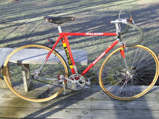
It was a Friday in early November and I was heading south on I89 on a beautiful day, heading for a full-day meeting in Boston. Hoping that I would have an hour or so of daylight after the meeting, I had tossed my trusty old Raleigh track bike into the back of the car. This bike has tons of stories of its own, but we won't go into them here. Suffice it to say that I have owned this bike since new and rode it enough to actually wear out a frame! Riding this bike taught me the value of a fixed gear bike for city riding; a realization that preceded the current fixation on fixies by decades. Since I would be in fairly flat Boston, I thought that the track bike was the perfect ride to bring along.


I had just crossed the Vermont- New Hampshire border when my cell phone rang. It was the organizer of the event telling me that it had been cancelled, due to a problem with the facility. Since I had already made arrangements for coverage for my classes and there was not time enough to get to school before half of them would be over, I decided to visit a couple of the schools that we support that are located on the east side of the state, instead.

I visited the instructors at Hartford Area Career & Technical Center in White River Junction and the River Valley Technical Center in Springfield, spending a couple of hours at each location. I wrapped up the visits around 1:00 and decided that there was time to get in a hilly loop, even if I didn't have the right bike for it. I drove to Chester and found a pull-off where I could park and change. I sped off on the track bike, hoping to get in about 50 miles before dark.

A track bike is not designed for road use, having a single, fixed gear (no coasting), short wheelbase and no brakes. I had long ago added a front brake and road tires. I also had installed wooden rims to help absorb some of the road shock and vibration that telegraphs through such a tight frame. The frame geometry of this bike is not extreme by today's standards but in the early 1970s, such a tight, 18 lb bike was considered a real screamer. The short wheelbase helps make up for the relatively high single gear ratio (48 x 16, in this case), but it can still be quite a grunt muscling up the really steep stuff.

With the declining daylight, I decided to cut off part of the ride by taking a "shortcut" through Andover. This is always risky when it's a road that you have not traveled before. Andover proved to be at the top of a significant climb, several miles long and steep enough to require an impressive switchback. The pavement was new and the road follows a classic Vermont mountain stream. Everything was fine until just after the switchback when I twisted my foot slightly and heard a SNAP and noticed one cleat was now sloppy in the pedal. I decided that it would be extremely difficult to get started again if I stopped, so I continued to the top of the climb where I stopped to discover that I had broken one of my cleats. Now, that's not such a surprise on a pair of 25-year old shoes with lots of miles, but it still can be a serious problem on a track bike, where good purchase on the pedals is critical. Going down descents means that you have to pedal at a very rapid pace, since you cannot coast or shift to a higher gear. Still, I didn't want to turn back, so I decided to take my chances and continue on the loop.

The descent down to Weston is quite steep, so I worked very hard, resisting the desire of the bike to rocket down the hill by pushing hard backwards on the pedals. You don't back pedal on a track bike like you would on a coaster brake. Instead, you apply backward pressure on the pedals in the same way that you apply forward pressure on a climb. The difference is that it's not as efficient, due to the position of the leg on the power stroke and you use a completely different set of muscles.

Half way down the slope I passed the only other rider I saw that day, who was riding a triple-zoot Trek up the hill. He sure gave me a funny look as I worked so hard pedaling down the hill! Once the slope eased up, I let the speed increase and concentrated on keeping up a high spin without letting the broken cleat slip out of the pedal.

I turned onto VT 100 at Weston and was happily spinning away the miles when I came to the intersection where 100 splits off from VT 155. It suddenly came to me where I was and that I would now have to go over Terrible Mountain before reaching Ludlow. I have strong memories of this climb, having done it many times from the other direction during the classic 100/200 double-century ride. Luckily, the climb from the south approach is shallower than from the north, though many times longer. As the second major climb of the ride, it took a lot of effort to muscle the fixed gear to the eventual summit; then it was another stand on the pedals and work the old Weinmann sidepull brake to control the speed on that nasty descent.

Once in Ludlow I clicked on my flasher, as the light was starting to fade and the traffic had picked up quite a bit. I spun up the pace as I passed VT 131, feeling very sorry that I would run out of light if I turned off on that incredibly beautiful road. If you ever get a chance, ride VT 131 from Ludlow through Cavendish. It is a gorgeous, gradual downhill that follows an incredible trout stream. It's pure joy on two wheels.

I had enough left in the tank to keep the RPMs up as I went over Proctorsville Gulf and down the other side. Once the road leveled off, it was only a few more miles to the pulloff where I had parked the car and I ended the ride just before the daylight started to fade.

The next day, I was stiff, but the second and third days I could hardly walk at all! As I said, the fixed gear uses a whole different set of muscles when going down hills and I had sure abused them. Moderation and training may be the key but still, I am glad to be able to say I've been over Terrible Mountain on a track bike!

Friday, October 20, 2006

Not Quite a SLAM

About six weeks ago, I got an email from a listserv announcing a running of the Six-Gaps bicycle ride. Vermont is known in many circles for its “gaps,” which are mountain climbs that wind up steep hillsides, passing through natural saddles formed between peaks. There are a number of these that crisscross the spine of the Green Mountains in the central part of the state. For some reason, the north-south pass on Route 108 outside of Stowe is called Smugglers Notch. What makes one pass a “notch” and another a “gap” is beyond me. Smugglers’ Notch is quite different from any of the gaps with it’s sheer rock cliff rising hundreds of feet on the west side—it really looks like a notch. Hazen’s Notch is significant, but much less of a climb than any of the gaps. Plymouth Notch is an easy ride and one wonders how it merits a name at all—go figure.

The Six-Gaps ride covers the named Vermont gaps, which include, in order, Lincoln Gap, Appalachian (App) Gap, Middlebury Gap, Brandon Gap, Rochester Gap and Roxbury Gap. The distance is a total of 116 miles with the gaps rising from 1500’ to 1800’ in elevation change . Grades on most of the climbs average around 10%, but Lincoln Gap is in a class by itself, with about a mile and a half of grades that reach 24%. To give a sense of perspective, the steepest grade you will encounter on a US interstate highway is 5%. San Francisco’s Lombard Street reportedly averages 14.3% . Lincoln Gap is not just steep—it’s stupid steep.

I filed the Six-Gaps ride into the back of my mind as a definite “maybe.” I hadn’t done a single truly epic ride this season, though I have logged many miles and quite a few mountain climbs. I’ve done three double-gap climbs, if you count Smugglers’ Notch as a gap. As the day of the ride approached, I decided to go for it but the weather changed to a dreary, cold, rain and the other riders all backed out, as did I. Now, how to justify the triple chainring setup I had bought to attack Lincoln Gap?

I’ve done a number of long rides and hard climbs. In my youth, I would ride to Massachusetts from Albany, NY, ride over Mt. Greylock, and return over Petersburgh Pass. Yet, a few years ago, I tried the Killington-Pico Cycling Club’s LAMB ride (Lincoln, App., Middlebury & Brandon Gaps) but bailed out half-way through. The fact that I was exhausted and my car was less than five miles away proved irresistible. Though I’m in decent riding shape, I don’t know if I could pull off the Six-Gaps ride without experiencing debilitating leg cramps—my greatest nemesis. Without the need to meet up with other riders, I started thinking that a different combination of climbs might be more convenient, hence the SLAM, for Smugglers’ Notch, Lincoln Gap, App. Gap and Middlebury Gap. If I can tackle these successfully, they can be extended to include other gaps, with an emphasis on clever acronyms.

The triple setup I purchased from Peter White Cycles is a TA triple adapter for my classic Campagnolo Super Record crank that allows the fitting of a third chainring that is much smaller than the normal 41 tooth of the double setup. Campy made a triple with a 36 tooth small ring and other manufacturers made a 30 tooth ring to fit this setup, but these cranksets are quite rare and expensive these days and the sub 36 tooth rings are virtually impossible to find.

Fitting the triple adapter and finding suitable derailleurs that would shift both it and a wide-range freewheel proved to be a much bigger challenge than expected. I ended up with a Huret Duopar rear changer and a Campy C-Record front. The TA adapter does not use the shift pins, ramps and gates of modern triples, so finding a chain and front mech combination that would shift from the middle to the inner ring proved quite problematic. Three derailleurs and four chains later, I had an adequately shifting bike, but it was after noon. If I could have started by 9, I would have been able to tackle the SLAM. With these short October days, though, I would have to shorten the ride.

Since the whole point of the triple was to get me over Lincoln Gap, I decided to ride to App Gap and do it from the west, crossing back over Lincoln Gap from the harder east approach. Starting right from home, I went down our steep 3.5 miles of dirt road and started right out climbing wicked-steep Wes White Hill. I don’t know what the grade is of this short paved road, but I suspect it is about 22%. The setup worked ok and I didn’t use the bottom gear, staying in the 30-26 combination on the steepest parts. I proceeded against a stiff headwind down to App Gap on the Main Road through Huntington and had no trouble climbing over the gap. I stayed in the 42-26, my normal gear for this climb, most of the way, dropping to the 30-26 for the 500 meter 19% grade pull to the top. The forecast was for rain starting sometime in the late afternoon and the sky was a mix of blue and dark, foreboding gray. Coming down the other side, I decided to take a detour down German Flats road to the Sugarbush Access Road, which proved to be a long but not-to-tough climb, followed by a fast descent back to Route 100.

A couple of miles south in Warren, I turned onto Lincoln Gap. I have heard it said that Lincoln Gap boasts the steepest mile of paved road in the continental US. I cannot prove or disprove this, but it is one steep climb. I’ve done it twice successfully with a 36-28, but it was quite a grunt. My first attempt a few years ago was with a 42-26 and I couldn’t do it. This time, I stayed in the 30-26 most of the way, dropping to a 30-34 for the last pull to the top. The 24% grade is so steep that you have to slide forward in the saddle to keep the front wheel on the ground. This problem was exacerbated by the shift into the 34 and I had to get out of the saddle or be especially smooth in my cadence.

The descent down Lincoln Gap’s west side is no fun. You need to really lean on the brakes going down the steepest paved section and use great caution on the gravel stretch. Once the pavement starts again, you can let ‘er rip and it’s a fast ride down to VT 116. I decided to complete the loop by climbing VT 17 up the “Baby Gap,” the climb and descent that precedes App Gap, and diverting back down the Main Road through Huntington. The south wind, which ceased to be a problem as I criss-crossed the Green Mountains on the gaps, became a nice tailwind. I kept up a quick 22-26 mph pace until it started raining just south of Huntington. I picked up the pace to a blistering 26-30 mph until turning onto Dugway Road, where I slowed down to cut the amount of mud thrown up from the dirt road. It was pretty dark by the time I hit the top of the 16% grade on our dirt road, so I was happy to arrive home in the cold drizzle.

A couple of hours after arriving home and wiping all the rain and mud off the bike, I heard a loud BANG. My last, beautiful old Clement Criterium Cotton sewup had blasted a hole in its sidewall. Should I mourn the loss of such a rare and classic link to the lost heritage of wonderful Italian handmade racing tires, or thank my lucky stars that it didn’t leave me by the side of the road, prying a tire off in the cold twilight rain? If only it had lost most of its tread, or flatted with a repairable puncture. Oh, well. At least it had a grand last ride.

As far as the gearing is concerned, I think I might see if I can find a 13-28 or 13-30 seven speed freewheel. It’s not so much a question of whether or not I can make it up Lincoln with a 30-28, but if I’ll have enough left afterward to do at least two more gaps. Time and a convenient Indian Summer day may tell.

Saturday, March 25, 2006

Double-Gap Ride--Too Early!

This has been a warm winter--too warm by Vermont standards. Interestingly, the snow level at the stake on Mt. Mansfield has tracked the average depth pretty closely, but there are huge drops, where the snow has almost disappeared. Unfortunately for the ski areas, those drops have typically been just before important weekends. Downhill areas that made snow did ok, though the conditions were rarely great, but the crosscountry areas took a real beating.

The thaws did make for a lot of early-season sloppy road biking. Luckily, I have a couple of bikes with fenders to keep the crud off, and a couple of those steeds have had to resign themselves to becoming the designated road salt rides. I have gotten in more miles by this time of year than any other since I moved to Vermont 25 years ago, including a couple of gap rides.

Vermont has a number of "gaps", really mountain passes that branch out east or west from VT 100, passing over the spine of the Green Mountains. The list is generally recognized as,
from north to south and east to west: Appalachian Gap, Lincoln Gap, Middlebury Gap, Brandon Gap, Moretown Gap, Roxbury Gap, and Rochester Mountain Gap (taken from Vermont Deathride). I would add the perhaps misnamed Plymouth Notch (really easy) and the wonderful Smuggler's Notch to the list. About the only difference is that gaps run east-west, and notches run pretty much north-south, but even that's not consistent, as in the case of Hazen's Notch. At any rate, the gaps and notches are favorite targets for cyclists. All are a challenge and some, like the stupid-steep Lincoln Gap, are epic memorable-for-a-lifetime rides for most cyclists. I ride Smuggler's Notch and Appalachian Gap several times a year, since both are on nice 50-60 mile loops from my house in Bolton.

So perhaps that's why I snapped at the bait when John Painter suggested a double-gap ride over Appalachian and Middlebury gaps, the route of the Green Mountain Stage Race, on March 11th. We met up near John's home in Starksboro and headed down VT 117 to the bottom of VT 17, where the App Gap starts. The temp was in the low '40s and I thought I might have been a little overdressed, though it didn't turn out that way. I was riding the Bianchi Squadra, as it had a 42x26 and index shifting--it was a good choice. John, of course, dropped me right away on the 'baby gap'. I caught him once, when he stopped to take off his jacket, but he didn't let that happen again. It's not that John is 20 years younger than me--he's just an amazing all-around athlete.

I didn't have any trouble getting the rest of the way up App Gap, and John is always kind enough not to take off at the top of climbs. I did my share of the pulling down VT 100 through Granville Gulf to Brandon where we took our only real break. Getting up Middlebury Gap was another thing, however. Middlebury Gap is easier than App Gap, but it grinds you down as it gets steepest at the top--in true Vermont gap fashion. About 2/3rd the way up, the leg cramps started and they stayed with me the rest of the ride, which was a long 30 miles. I'd be going along just fine when "WHAM", I'd get a slamming pain in the leg. Calf, thigh, left leg, right leg, they all took their turns tormenting me. Still, the wind cooperated, dying down toward the end of the day when it became a headwind, the sun poked out a few times, we rode past melting snowfields, ticked off a couple of gaps and got in a rugged 65 miles, earning some serious bragging points for this early in the season. Woo-Hoo!!!
VT-BUDS is online!

http://vtbuds.com is a website for Vermont tandem teams to connect for rides and to post ride reports--s sort of tandem rideboard. The site is setup so that people can post ride photos in their announcements and reports. The site is up and running just in time for Vermont's riding season (I saw four other riders on my 30 mile round-trip commute yesterday). I think this is an original idea, so time will tell if it takes off or fizzles. The hope is that it will encourage people to ride tandems by making it easier to connect with others. Tandems are socially oriented by their very nature. And if more tandems are seen out on the road, more people will be interested in giving them a try. Tandems are a positive image for cycling. While some people immediately get annoyed when they have to slow down to pass a single cyclist or, even worse, a pair of cyclists riding side-by-side, everyone likes to see a tandem!